Welcome to Automating GIS processes/ FEC 2017!
6.-10.3.2017 at the Kumpula Campus, University of Helsinki. Rooms A113-A114.

This course will introduce you the basics of programming and automatization of GIS-processes in the Python programming language.
Materials have been tailored for the further education course Paikkatiedon käyttö ja hyödyntäminen F.E.C. organized by HY+.
The course consists of interactive lectures and exercises. All course material will be distributed via these pages. Materials are based on previous further education courses and two more extensive course packages: Python for geo-people and Automating GIS-processes developed at the Department of Geosciences and Geography, University of Helsinki.
Course schedule:
The course is divided into three blocks. During the first days of the course, we will learn the basics of python. During the last days of the course we will apply the basic skills using the ArcPy-model for automating GIS-processes. Here is the preliminary schedule for the course (might be subject to changes depending on how fast we proceed as a group!)
| Day | Theme | Content |
|---|---|---|
| Monday | Basics of Python 1 |
|
| Tuesday | Basics of Python 2 |
|
| Wednesday | Basics of Python 2 Automating ArcGIS Processes |
|
| Thursday | Automating ArcGIS Processes |
|
| Friday | Automating ArcGIS Processes |
|
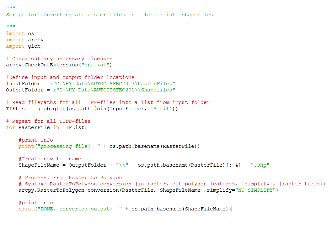
At the end of the course you should be able to generate, understand and use code for automating GIS-processes such as the one below.

Course contents:
Basics of Python 1
Basics of Python 2
Automating ArcGIS-processes
- Automating ArcGIS-processes
- Model Builder tutorial
- ArcPy-module
- Exercise 4: Species data to raster
- ArcGIS Toolbox
- Species tool: Version 1 (toolbox)
- Species tool: Version 1 (script)
- Running the Python script from ArcGIS
- Species tool: Version 1.5
- Species tool: Version 2
- Running the Complete tool
- Arcpy Summary